Traditional navigation apps get you from point A to point B. They show roads, calculate routes, and tell you when to turn. They’re built for pavement, designed for efficiency, optimized for the predictable.
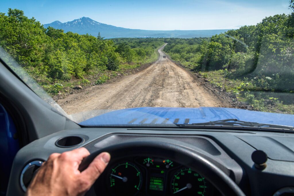
But overlanding isn’t about efficiency. It’s about discovery. Challenge. Experience. The breathtaking viewpoint you found after that technical climb. The perfect dispersed campsite tucked into the pines. The route that tested your skills and rewarded your preparation. These moments deserve more than fading memories and a few photos buried in your camera roll.
Modern adventure platforms do something traditional navigation never could—they support the entire journey from that first spark of “where should we go?” through planning, execution, documentation, and sharing. No Roads transforms overlanding from isolated experiences into a connected adventure lifecycle where every trip builds on the last and contributes to the next.
The adventure lifecycle: More than just navigation
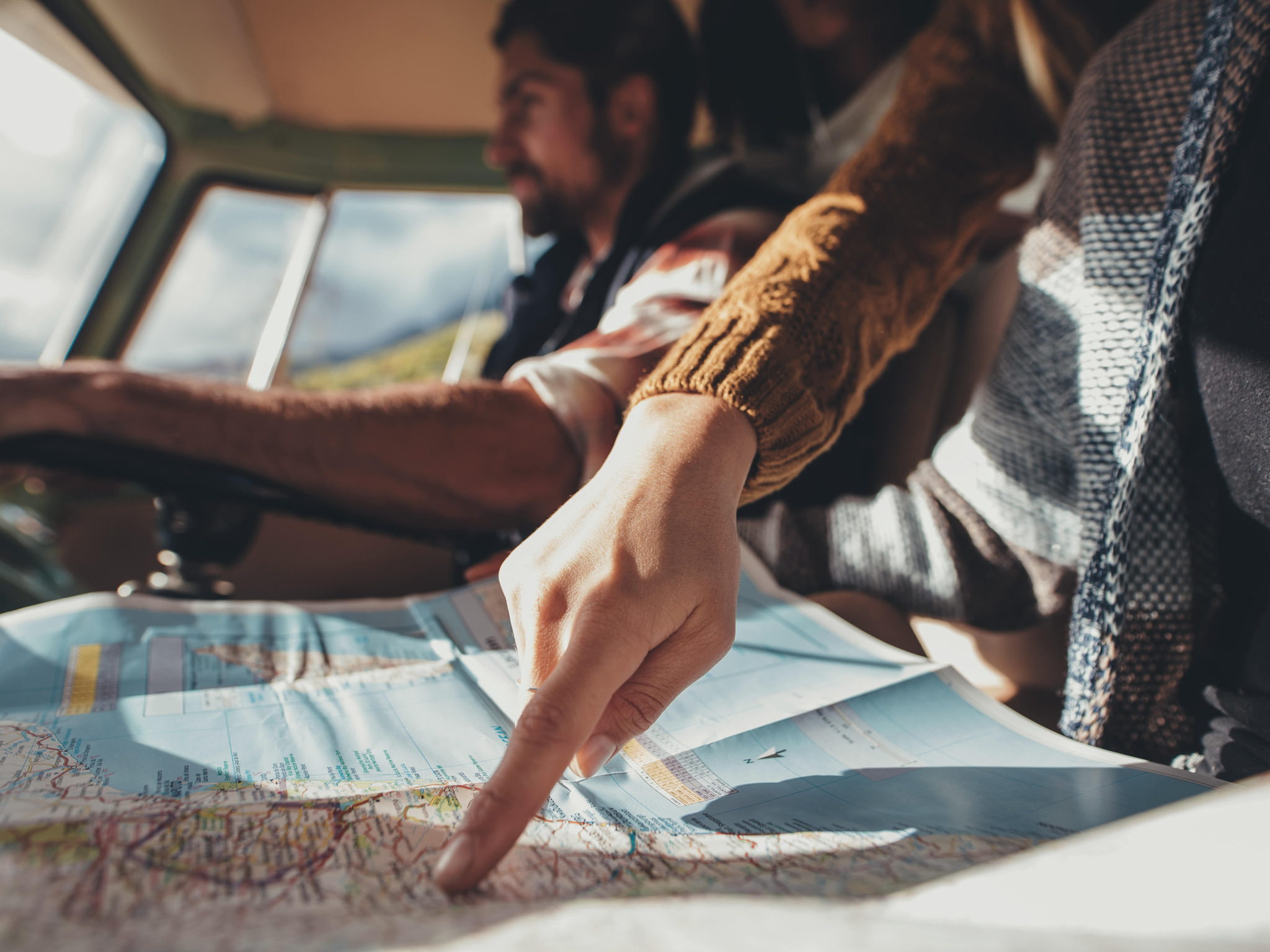
Think about how most people approach off-road adventures. They might browse Instagram for ideas, check a forum for trail reports, download some GPX files, screenshot a few key points, maybe message friends for recommendations. The information scatters across apps, browser tabs, and text threads. Planning feels chaotic. Execution means constantly switching between tools. And afterward? Maybe they post a few photos, but the detailed knowledge they gained—that tricky junction, those current conditions, that perfect camping spot—disappears with them.
This fragmented approach leaves value on the table at every stage. Modern adventurers need platforms that support the complete adventure cycle, not just one piece of it.
Discovery and planning: Before you ever start your engine, the adventure begins with possibility. Modern platforms let you explore thousands of trails visually, assess them through community intelligence, and organize everything into cohesive trip plans. This isn’t just looking at maps—it’s understanding what awaits through photos from fellow adventurers, ratings that show trail character, and insights that help you match routes to your capabilities.
Preparation and confidence: With your destination chosen, preparation determines success. Download offline maps so connectivity won’t limit your navigation. Organize waypoints, saved trails, and points of interest into trip-specific collections. Review community insights about current conditions. This preparation transforms uncertainty into confidence, letting you focus on experience rather than logistics.
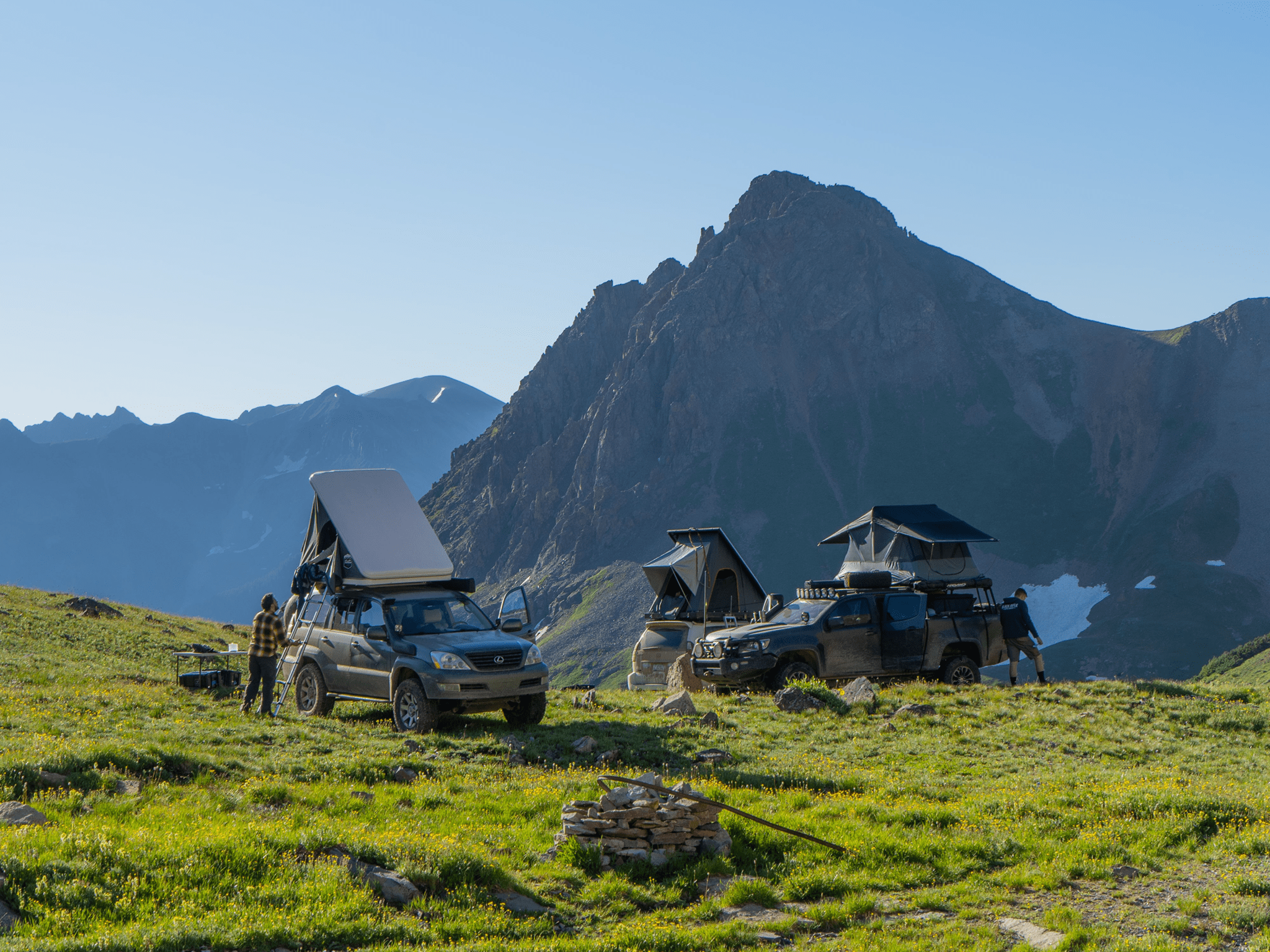
Execution and documentation: On the trail, modern platforms do more than show your location on a map. They capture comprehensive records of your journey—elevation gained, distance covered, speed variations, timing. They let you mark discoveries worth remembering, report obstacles to help others, and maintain awareness of your group’s locations. Your adventure becomes data that serves both immediate navigation and future planning.
Preservation and sharing: After you return, the adventure shouldn’t end. Save detailed tracks with photos and notes. Organize experiences into collections that tell stories. Share discoveries with friends who can benefit from your real-world intelligence. Build an adventure library that becomes more valuable with every trip.
This complete cycle is what separates modern adventure platforms from basic navigation tools. It’s the difference between “getting there” and fully experiencing, documenting, and sharing outdoor exploration.

Discovery: Finding adventures worth taking
Every great journey starts with a destination, but how you discover that destination shapes the entire experience. Modern platforms transform discovery from tedious research into engaging exploration.
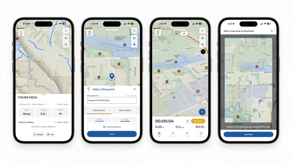
Visual trail exploration: Open No Roads and you’re immediately exploring—thousands of trails appear as blue lines, points of interest as blue pins. Zoom into regions that interest you, or search for specific locations you’ve heard about. This visual approach reveals trail networks, shows proximity to points of interest, and helps you understand an area’s adventure potential at a glance.
Community intelligence that tells the real story: Tap any trail and you access more than distance and elevation—you see what fellow adventurers actually experienced:
- Riding style ratings show where trails fall between rocky/technical and smooth/fast, giving you better understanding than generic difficulty ratings that mean different things to different people
- Thumbs up/down percentages reveal overall community sentiment about the trail experience
- Review tags surface common characteristics: scenic views, great camping, narrow sections, loose rock—the details that actually influence decisions
- Photos and videos from the community provide visual evidence of current conditions, terrain types, and highlights
This community-driven intelligence transforms trail selection from guesswork into informed decision-making.
Finding the complete experience: Don’t stop at trails—explore points of interest that enhance adventures. POI markers highlight campsites, viewpoints, and notable locations, each with community ratings and photos showing what makes them special. This comprehensive view helps you plan not just routes, but complete experiences.

Planning: Organizing for success
Once you’ve discovered trails worth exploring, organization determines whether planning feels overwhelming or manageable. Modern platforms centralize everything in one place.
Building trip collections: Create collections specifically for each adventure—”Moab Spring 2025″ or “Colorado Loop Trip.” Save trails, POIs, and custom waypoints all together. Everything stays organized and accessible, synced across devices, ready when you need it.
Custom waypoints for your specific plans: Beyond trails and POIs from the database, drop personal waypoints for planned camping spots, fuel stops, meeting points, or anything relevant to your trip. Customize each with icons, names, and notes that make sense for your adventure.
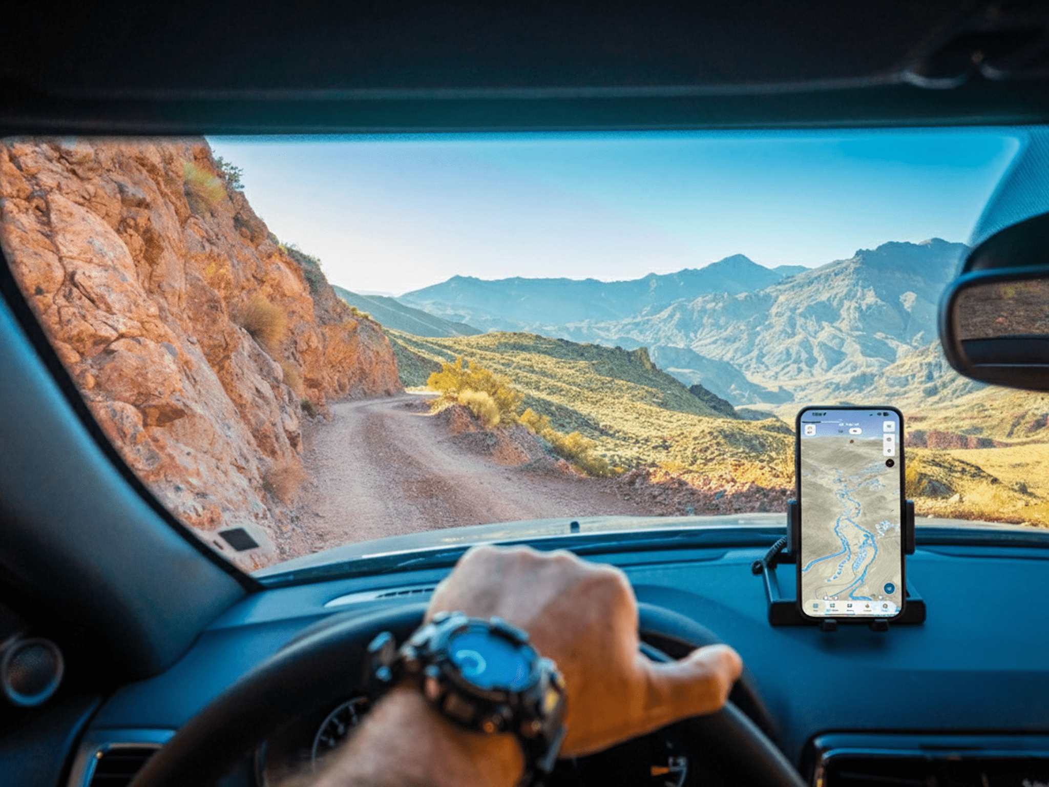
Preparing for offline access: The best routes often venture far from reliable cell coverage. Download offline maps for your route area plus extra buffer space for potential detours. With maps downloaded, you maintain full access to trail data, POIs, waypoints, collections, and the ability to record tracks and create new waypoints—everything needed to navigate confidently regardless of signal availability.
Optional route planning preview: No Roads+ subscribers can access route planning in early development through our Early Access program (available in settings). This tool lets you visualize your journey directly on the map. Keep in mind that early access features are works in progress and may not work perfectly—always verify routes with current conditions and regulations before your adventure.
Execution: Navigating with confidence
Planning pays off when you arrive at your starting point. Everything you prepared appears on your map, ready to guide your exploration while you stay flexible enough to embrace unexpected discoveries.
Starting your documented journey: Tap the blue plus button and select “Record track” to begin. No Roads automatically switches to 3D map view, providing enhanced terrain visualization perfect for off-road navigation. Select up to four parameters to monitor during your journey—elevation, distance, speed, duration, coordinates, accuracy, direction, max speed, or sunrise/sunset times. Change these parameters anytime to focus on information relevant to your current situation.
Following your plan while staying flexible: Your saved trails and waypoints remain visible during track recording, serving as visual guides for your intended route. The 3D view helps you understand terrain ahead and identify landmarks or junctions. But adventures rarely follow plans exactly—when you encounter something unexpected, drop new waypoints to mark discoveries or report hazards to alert fellow adventurers.
Enhanced awareness with No Roads+: Premium subscribers can add mapping layers during recording to enhance navigation and safety:
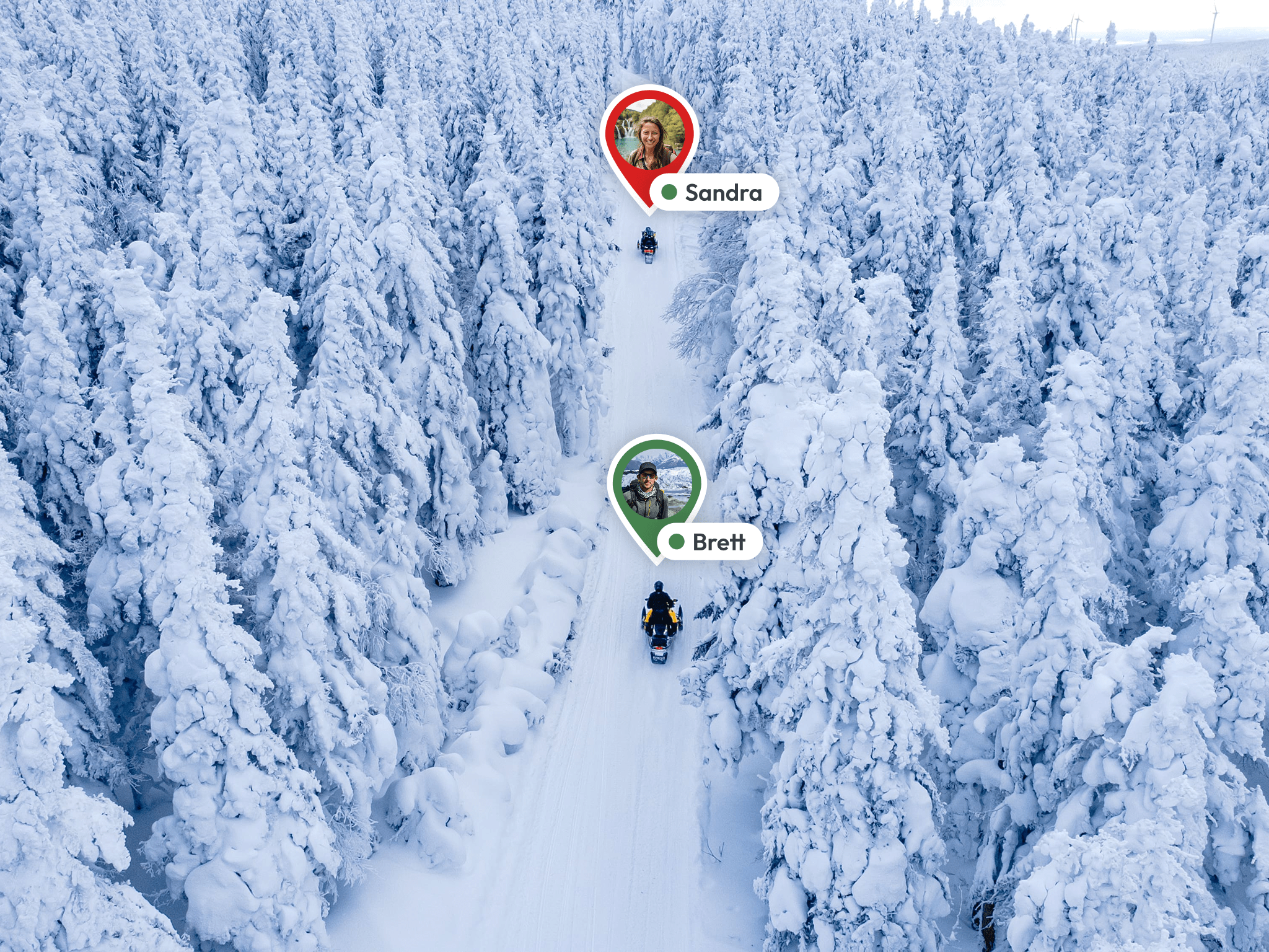
- Friends on the map: See real-time locations of your group members, ensuring coordination without constant radio chatter
- Weather overlays: Monitor smoke, fire, and lightning strikes to stay ahead of changing conditions
- Public land boundaries: Understand which agency manages each area and what access rules apply
- Detailed topography: Access USGS maps and elevation data with multiple rendering styles
Managing complexity through visibility control: With multiple data layers active, toggle visibility to show only what matters for your current situation—weather as conditions change, friends’ locations during technical sections, or basic trail view during straightforward stretches.
Documentation: Capturing the experience
Active track recording captures comprehensive data without requiring constant attention, but several features let you enhance the record as you progress.
Real-time documentation: While paused or during stops, add notes about current conditions, attach photos of interesting sights, or capture videos of technical sections. This real-time documentation creates richer records than trying to remember details days later.
Building complete records: Your track captures more than just where you went—it records elevation changes, speed variations, distance covered, and timing information. Combined with your photos, notes, and waypoints, you’re creating comprehensive adventure documentation that serves both as personal memory and community intelligence.
Monitoring progress: Glance at your selected parameters to understand distance traveled, elevation gained, or time elapsed. This information helps with fuel planning, timing decisions, and assessing pace against your intended route.
Completion: Preserving your adventure
When your journey concludes, saving your track preserves a complete record while opening opportunities to share discoveries with your community.
Ending and organizing: Tap “Pause” then “End Recording” to open the completion screen. Give your track a descriptive name—”Moab Hell’s Revenge October 2024″ helps more than “Track 47.” Add notes about conditions, challenges, or highlights while they’re fresh. Attach photos and videos that capture the experience. Save to relevant collections for easy future reference.
Understanding what you accomplished: Your saved track shows duration, distance, and average speed, plus speed and elevation profiles that visualize the journey’s character. These statistics help you understand what you achieved and estimate timing for similar future routes.
Cloud synchronization: Your tracks sync automatically across devices. That adventure you recorded on your phone? It’s available on your iPad for trip planning, your computer for detailed review, anywhere you access No Roads.
Sharing: Connecting with your community
Great routes deserve to be shared. When you discover an amazing trail or solve a navigation challenge, your friends in the No Roads community can benefit from your experience.
How sharing works: From your track profile, tap share and select which friends to receive it from your connected friends list. Your shared track appears in their activity feed within the app, complete with statistics, photos, and notes you’ve added.
Why sharing matters: Your real-world experience becomes valuable intelligence for friends planning their own adventures. They see what to expect on trails they’re considering, can ask questions about specific sections, and get inspired for explorations they might not have discovered otherwise. Sharing transforms individual experiences into community knowledge.
Building your adventure library
Each completed trip adds to your growing adventure database, creating resources that become more valuable over time.
Tracks as future planning tools: That track you recorded last spring? It’s now reference data for estimating time and distance on similar terrain. The elevation profile shows exactly what climbs to expect. Your notes remind you about that tricky junction or perfect camping spot. Every adventure becomes intelligence that informs future planning.
Collections that tell stories: Your trip collections evolve from planning documents into complete adventure records. They contain not just what you intended, but what you accomplished—complete with photos, notes, and detailed telemetry. These collections become your personal adventure archive.
The compounding effect: As your library grows, each new adventure builds on previous experiences. You understand your vehicle’s capabilities better. You recognize terrain types and estimate challenges more accurately. You build confidence that enables bigger, bolder explorations. This is how adventurers evolve from tentative to experienced—through accumulated, documented experience.

Beyond navigation: The complete platform
This is what separates modern adventure platforms from traditional navigation apps. Basic navigation shows you where you are and where you’re going. But overlanding deserves more than basic directions.
You deserve tools that support discovery through community intelligence. Planning through organized collections and offline preparation. Execution through comprehensive documentation and enhanced awareness. Preservation through detailed records and cloud synchronization. Sharing through connected community features.
You deserve platforms built specifically for the unpaved paths, the technical challenges, the scenic detours, and the discoveries that make overlanding meaningful. Platforms that understand adventures don’t end when you park—they continue through the sharing, the planning for next time, and the building of lifetime adventure libraries.
Your next adventure awaits
Whether you’re planning your first overlanding trip or your hundredth, modern adventure platforms transform how you discover, experience, and share outdoor exploration. The tools exist to support every phase of your journey—from that initial spark of possibility through confident execution to meaningful preservation and sharing.
The trails are waiting. The community is ready to share their knowledge and benefit from yours. The platform is built to support your complete adventure lifecycle. The only question remaining: where will your next documented journey take you?
Any terrain. Any adventure. No limits. No Roads.