Maps & Trail Data
Access base maps, 3D views, and thousands of trails and points of interest with basic offline capabilities.
No Roads | Off Road Trail Maps & Discovery App for Adventurers

Chart your course with No Roads+ premium off-road trail maps. Upgrade to unlock enhanced navigation features designed for adventurers who demand more from their mapping experience. Navigate any terrain with confidence, whether blazing new trails or exploring the path less traveled.
Access base maps, 3D views, and thousands of trails and points of interest with basic offline capabilities.
Discover trails and points of interest with detailed information, community ratings, photos, and real-world insights from fellow adventurers.
Record tracks, create routes, and set waypoints to document your journeys.
View trail ratings, access points of interest, and share photos from your adventures.
All the basic features, plus premium extras to enhance your adventures.
See friends on your map in real-time and share your location for better group coordination.
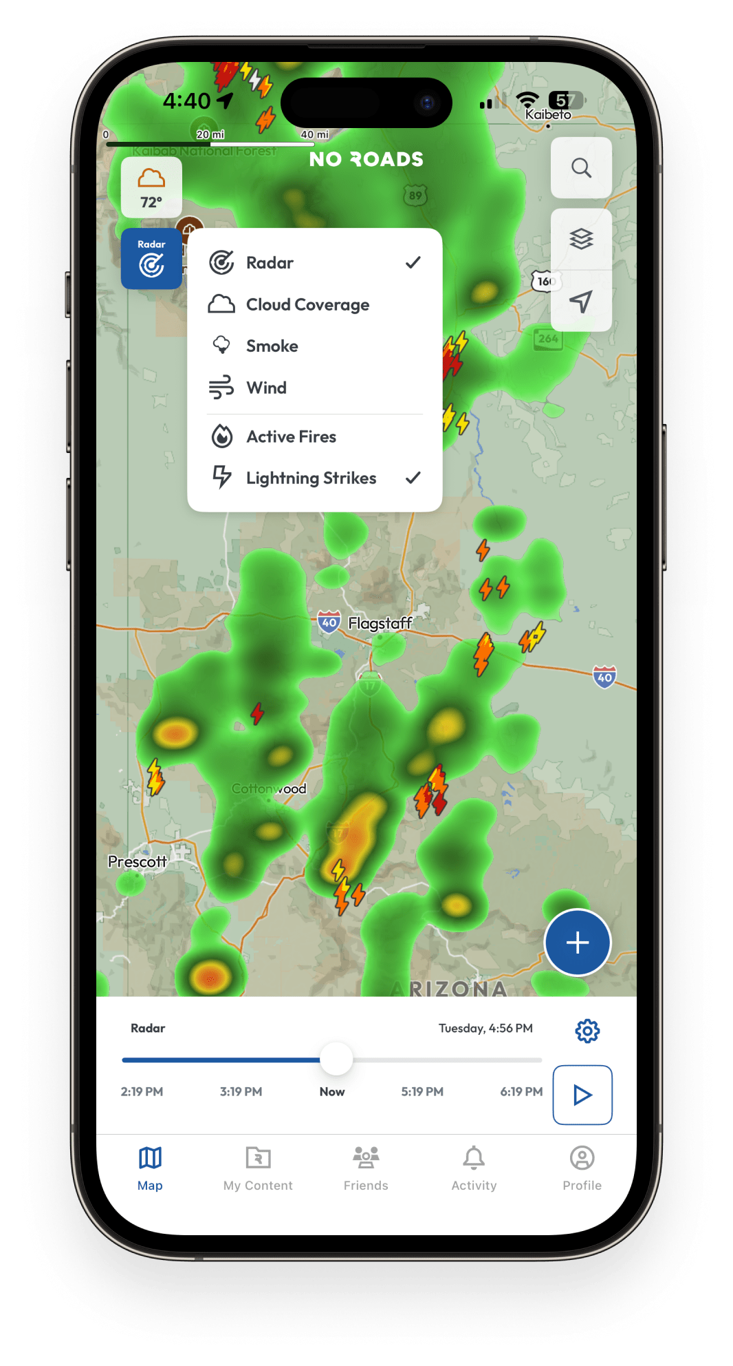
Radar, wind, clouds, smoke, fire, and lightning data layered directly on your maps for safer planning and real-time conditions monitoring.
Enhanced topography, public land boundaries, and detailed legends for smarter navigation and trip planning.
Topo, hybrid, and satellite views
Download maps for use without cell service
Visualize elevation and topography
Comprehensive information on trails and landmarks
Document and save your routes
Mark important locations
Submit and view hazards
Add friends to your No Roads network
Essential weather information
View friends' locations on your map
See real-time positions of your friends during group rides and adventures. Coordinate better, stay connected, and keep your entire group on track even when trails diverge.
Radar, wind, clouds, smoke, fire, lightning
Plan your adventures with confidence using weather data layered directly on your maps. Monitor real-time conditions, track approaching storms, and make smarter route decisions based on weather threats.
Public lands, advanced topography, USGS maps, hillshade, slope data
Navigate with enhanced intelligence through color-coded land management boundaries, detailed elevation data, and professional topographic overlays. Understand terrain characteristics and access restrictions before you arrive.
Plan your adventures with confidence using weather data layered directly on your maps.
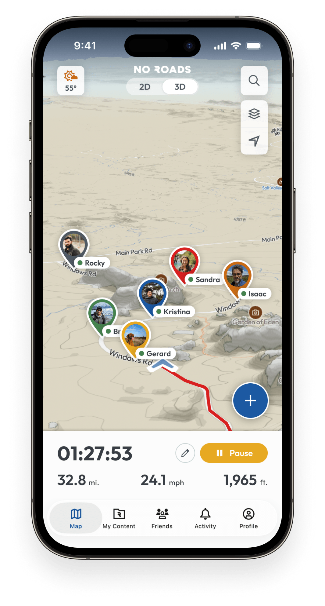
See your friends’ locations on the map during group rides and adventures.
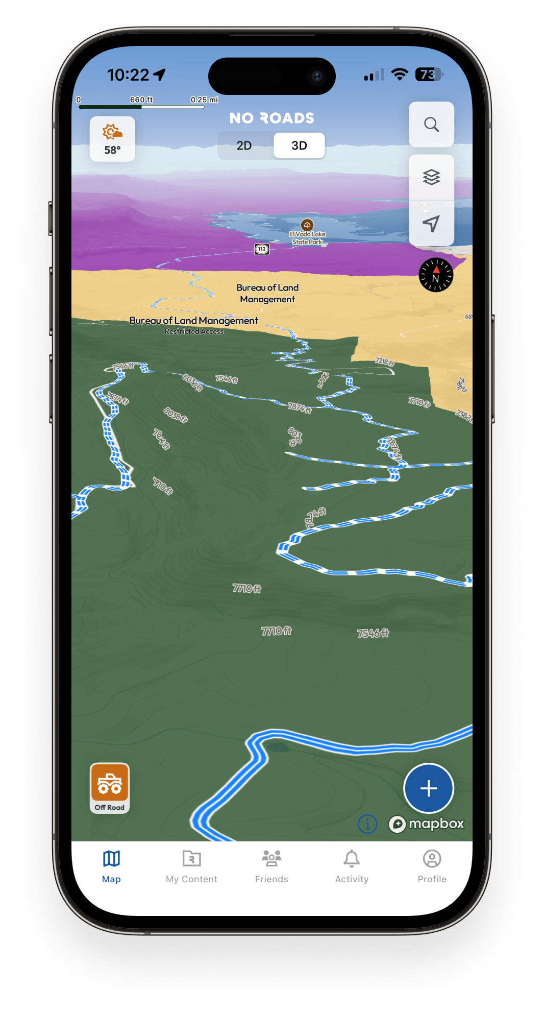
Navigate with enhanced intelligence through detailed topography and land management data.
From forests to mountains, deserts to valleys – where will your next adventure take you?
Remember, there are No Roads.